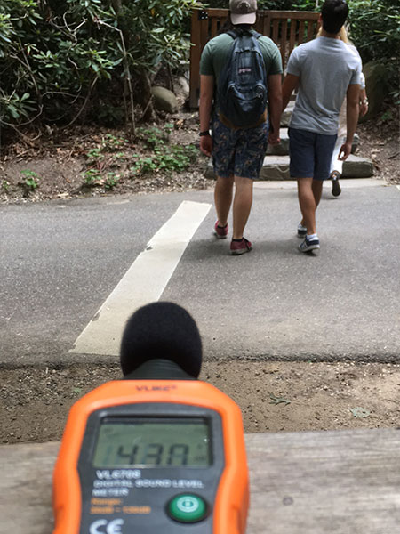
Hiking through the mature forest at Avalon Park & Preserve, birdsong and raindrops hitting the leaves dominate the soundscape. A lawn mower starts up, then drones on, fading into the background as the rain grows heavier. Suddenly, a car speeds by on a nearby gravel road.
These rich sounds—both natural and manmade—overlap to form an ephemeral soundscape that can elicit emotions and ground us in a sense of place, often without our awareness. How then, as landscape architects and ecological planners, can we harness the power of sound to enrich the experience of a landscape? We’re determined to find out.
In partnership with Andropogon’s master planning team, headed by Darren Damone, PLA, and Brooklyn-based sound consultant Michael I. Mandel, PhD, Andropogon’sintegrative researchersare developing innovative methods to digitally map Avalon’s 215-acre soundscapeon the North Shore of Long Island. By assessing sound quality and temporal variations at key locations throughout the property, the master planning team will be able to locate programming (such as a yoga pavilion) in areas with appropriate auditory experiences (such as a meditative environment).
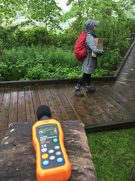
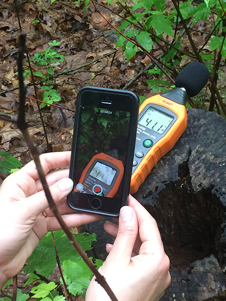
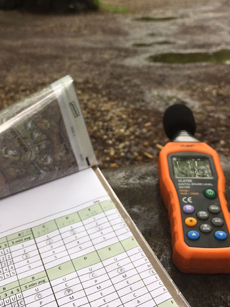
In June, Andropogon researchers Emily McCoy, PLA, and Lauren Mandel, PLA, headed into the field to collect baseline data with the help of landscape designer, Hanna Gold, and interns Ellie Lerner and Dorothy Jacobs. Using a digital sound level meter, we monitored the sound levels at 11 predetermined locations. In order to store these sound levels and audio, we simultaneously recorded video of the meter’s screen with an iPhone—a hack that saved hundreds of dollars by avoiding the need for a data logger! After capturing these acoustical measurements, we completed a Sound Assessment Form for each monitoring location. This is important because sound levels don’t necessarily indicate whether a sound is pleasant or not. For example, a loud sound could be a flock of birds (pleasant) or a truck shifting gears (unpleasant). Additionally, we’ve found that each person perceives sound volume and quality in their own unique way, so it’s important to collect as much data as possible before drawing any conclusions.
We will soon analyze the baseline data, and then use this “ground truthing” to test the accuracy of a GIS model that maps assumptions of pleasant and unpleasant sound levels throughout the site. Tweaking the GIS model will help the master planning team gain confidence that the soundscape will enrich, rather than detract from, Avalon’s future landscape experience.
Want to learn more and hear from a professional soundscape ecologist?! Check out this podcast.